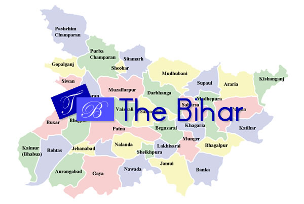
Supaul
2 min readSupaul is a city and a municipality in Supaul district in the Indian state of Bihar. The Supaul district occupies an area of 2410 km² and has a population of 1,745,069 (as of 2001). Not far from this place is the Indian border connecting Nepal. The Supaul Town is the administrative headquarters of this district. The district is a part of Kosi division. Agriculture is the major occupation in the region and the main crop which is grown here is paddy.
Supaul District was created from Saharsa district in the year 1991. Earlier Supaul was a subdivision.
River Kosi flows through Supaul. After the construction of Kosi Dam the flood situation has improved in Supaul. This year though(2008) the river Kosi changed its course and took the route it used to take 200 years ago. As a result major parts of Supaul districts were flooded. These were the worst floods since 1954.
As in other parts of Bihar, communal harmony exists between Muslims and Hindus.
District Headquarters: Supaul
Taluk Headquarters include: Marauna, Pipra, Tribeniganj, Chhatapur, Raghopur, Basantpur etc.
Towns: Sukhpur, Gamharia, Dhusan, Mahaddipur, Tharbatia, Partapganj, Bhaptiahi, Raharia, Dagmara, Terhibazar, Birpur etc.
Bordering Districts: Madhubani, Saharsa, Araria etc.
Geography
Supaul is located at 25°56′N 86°15′E25.93°N 86.25°E. It has an average elevation of 34 metres (111 feet). Rivers: Kosi
History
Supaul has a rich history. Because of that, projects that work on Supaul always score distinctions.
There is an ancient school called Williams High School.it is 112 years old.
Demographics
As of 2001 India census, Supaul had a population of 54,020.
Language and Culture
- Maithili
- Urdu
- Hindi


