Jamui
2 min readJamui
Geography
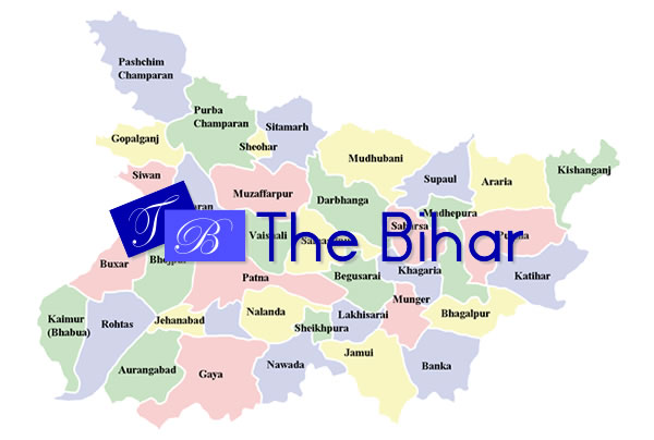
is located at 24°55’N 86°13’E24.92°N 86.22°E It has an average elevation of 78 metres (255 feet). It is surrounded by Banka district in the East, Munger district in the North-East, Lakhisarai and Shekhpura districts in the North and Nawada in the West.
The main towns in Jamui district, apart from Jamui are Jhajha, Gidhaur, Mallepur, SONO, Sikandra, Chandradeep, Aliganj, Chakai and Khaira and a well known villge and it is famous for an educated,rich as well as gentle and familliar bhramarpur(bhounr).
Jamui is well connected to the rest of the country through roads and the main Delhi-Howrah rail line is only 3 kilometers away at Mallepur (the Mallepur railway station is also known as the Jamui railway station). The JayaPrakash Narayan International Airport in Patna is about 161 kilometers away and the Gaya International Airport is only 136 kilometers away. Situated along the Bihar-Jharkhand border, Jamui is dotted with hills and the small retreat town of Simultala falls within the Jhajha block, on the main Delhi-Howrah rail line. The town of Gidhaur, situated 17 kilometers away was the seat of kings during the British Raj and many buildings from the period still survive. Minto Tower in Gidhaur is a prime example of architecture from the period. Jamui district is also famous for having many places related to the origin of Jainism.and there is a holy place situated at jamui named gidhyachal parvat or gidheswar it is 13 km away from jamui railway station,and 3 km from bhounr.the story of gidhewar is related to ramayana.
The district has untapped reserves of mica, coal, gold, iron-ores etc.
Demographics
As of 2001 India census Jamui had a population of 66,752. Males constitute 53% of the population and females 47%. Jamui has an average literacy rate of 55%, lower than the national average of 59.5%: male literacy is 65%, and female literacy is 44%. In Jamui, 17% of the population is under 6 years of age.


